Wildfire Risk Mitigation Strategy Presentation Template

Stop wasting hours on manual formatting. Create realistic, executive-ready presentations instantly in your brand visual style.

Hazard map, fuel-load, defensible-space, and exposure prioritization slides
Incident reduction, resource allocation, readiness, and response KPI dashboards
Governance, community protection, risk register, and implementation charter visuals

1What a Wildfire Risk Mitigation Deck Needs to Prove

A wildfire risk mitigation presentation should prove that the organization understands where exposure is concentrated, which interventions reduce risk most, and how resources will be deployed before the next high-risk season. Leaders need to see hazard zones, fuel loads, ignition sources, vulnerable communities, critical infrastructure, response capacity, funding gaps, and implementation ownership. The deck should connect risk evidence to specific actions such as vegetation management, defensible space, grid hardening, evacuation planning, detection systems, community outreach, and emergency response readiness. It should also make tradeoffs visible because resources are rarely sufficient for every location at once. This gives emergency managers, forestry teams, utilities, infrastructure owners, insurers, resilience planners, public safety leaders, community stakeholders, finance teams, PMOs, and consultants enough evidence to assess hazard exposure, intervention priority, resource readiness, community impact, operating risk, governance maturity, and implementation sequencing. The narrative should also define risk owners, mitigation actions, funding gates, response dependencies, and readiness checkpoints for each rollout wave.
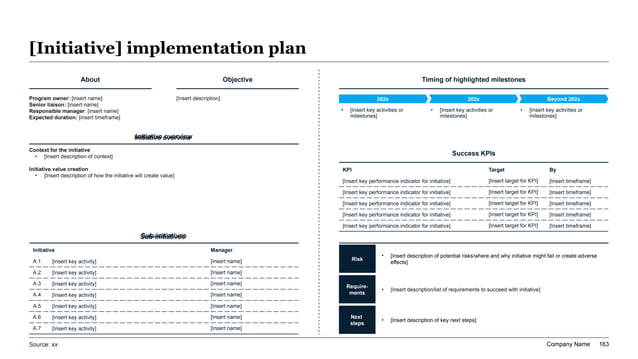
Wildfire risk mitigation implementation charter slide with dual-panel dashboard, initiative tables, KPI metrics, and risk register blocks.
Template Design LayoutWildfire Risk Mitigation Strategy Presentation Template

2Who This Template Is Built For

This template is built for teams that need to present wildfire mitigation as a coordinated operating program. Typical users include emergency management agencies, forestry departments, land management teams, utilities, municipalities, county and state resilience teams, infrastructure owners, insurers, climate risk analysts, public works leaders, community safety organizations, and consultants. It is useful when stakeholders must decide where to fund mitigation, how to prioritize fuel reduction, which communities or assets need protection first, and how preparedness work will be governed. The audience usually needs a practical plan that blends environmental data, infrastructure risk, community safety, and implementation capacity. This gives emergency managers, forestry teams, utilities, infrastructure owners, insurers, resilience planners, public safety leaders, community stakeholders, finance teams, PMOs, and consultants enough evidence to assess hazard exposure, intervention priority, resource readiness, community impact, operating risk, governance maturity, and implementation sequencing. The narrative should also define risk owners, mitigation actions, funding gates, response dependencies, and readiness checkpoints for each rollout wave.

3Hazard Mapping and Exposure Baseline

The hazard baseline should show where wildfire risk is highest and why. It should cover vegetation type, fuel density, slope, wind exposure, drought conditions, historical fires, ignition points, climate projections, access roads, evacuation constraints, population exposure, and critical infrastructure. The deck should also identify communities, substations, transmission corridors, water assets, hospitals, schools, and transportation links that sit in priority risk zones. A useful map separates probability, severity, vulnerability, and consequence so mitigation choices are not based on a single risk score. This gives emergency managers, forestry teams, utilities, infrastructure owners, insurers, resilience planners, public safety leaders, community stakeholders, finance teams, PMOs, and consultants enough evidence to assess hazard exposure, intervention priority, resource readiness, community impact, operating risk, governance maturity, and implementation sequencing. The narrative should also define risk owners, mitigation actions, funding gates, response dependencies, and readiness checkpoints for each rollout wave and seasonal review cycle before annual funding approval decisions.

4Fuel Reduction and Landscape Treatment Strategy

The fuel management section should explain which treatments are recommended and where they create the greatest risk reduction. It may cover mechanical thinning, prescribed fire, grazing, fuel breaks, defensible space, road clearing, invasive species management, and post-treatment maintenance. The deck should prioritize treatments by hazard severity, proximity to communities, ecological constraints, cost, permitting, workforce capacity, and expected duration of benefit. It should also show where treatment is not appropriate or where ecological tradeoffs require careful design. A strong strategy connects landscape interventions to measurable reductions in flame length, spread potential, ember exposure, or suppression difficulty. This gives emergency managers, forestry teams, utilities, infrastructure owners, insurers, resilience planners, public safety leaders, community stakeholders, finance teams, PMOs, and consultants enough evidence to assess hazard exposure, intervention priority, resource readiness, community impact, operating risk, governance maturity, and implementation sequencing. The narrative should also define risk owners, mitigation actions, funding gates, response dependencies, and readiness checkpoints for each rollout wave.

5Community Protection and Evacuation Readiness

Community protection pages should show how mitigation improves safety for people, homes, businesses, and public services. The deck should cover defensible space, home hardening, evacuation route capacity, shelter planning, public alerts, vulnerable population support, community education, emergency communications, and coordination with fire agencies. It should identify communities with high exposure and limited response capacity, then show which actions are planned before peak fire conditions. The presentation should also address equity, because lower-income or remote communities may face higher risk and lower ability to self-mitigate. This gives emergency managers, forestry teams, utilities, infrastructure owners, insurers, resilience planners, public safety leaders, community stakeholders, finance teams, PMOs, and consultants enough evidence to assess hazard exposure, intervention priority, resource readiness, community impact, operating risk, governance maturity, and implementation sequencing. The narrative should also define risk owners, mitigation actions, funding gates, response dependencies, and readiness checkpoints for each rollout wave and seasonal review cycle before annual funding approval decisions.

6Infrastructure Hardening and Utility Risk Controls

Infrastructure sections should identify assets that could fail during fires or contribute to ignition risk. Relevant topics include power lines, substations, communication towers, water systems, roads, bridges, hospitals, emergency facilities, and critical supply routes. Utility risk controls may include vegetation clearance, covered conductors, undergrounding, sectionalization, equipment inspection, grid monitoring, public safety power shutoff protocols, and rapid fault detection. The deck should connect asset hardening to service continuity, ignition prevention, response access, and community resilience. It should also identify dependencies on permitting, capital budgets, workforce, technology vendors, and multi-agency coordination. This gives emergency managers, forestry teams, utilities, infrastructure owners, insurers, resilience planners, public safety leaders, community stakeholders, finance teams, PMOs, and consultants enough evidence to assess hazard exposure, intervention priority, resource readiness, community impact, operating risk, governance maturity, and implementation sequencing. The narrative should also define risk owners, mitigation actions, funding gates, response dependencies, and readiness checkpoints for each rollout wave.

7Detection, Monitoring, and Early Warning

The monitoring section should explain how wildfire risk will be detected and tracked before incidents escalate. It may cover weather stations, fuel moisture sensors, cameras, satellite data, lightning detection, patrols, AI smoke detection, asset inspections, and public reporting channels. The deck should define alert thresholds, monitoring owners, escalation paths, and how information flows into emergency operations. It should also show how seasonal forecasts and real-time conditions change resource allocation. Detection does not replace mitigation, but it can reduce response time and improve situational awareness when high-risk conditions emerge. This gives emergency managers, forestry teams, utilities, infrastructure owners, insurers, resilience planners, public safety leaders, community stakeholders, finance teams, PMOs, and consultants enough evidence to assess hazard exposure, intervention priority, resource readiness, community impact, operating risk, governance maturity, and implementation sequencing. The narrative should also define risk owners, mitigation actions, funding gates, response dependencies, and readiness checkpoints for each rollout wave and seasonal review cycle.

8Resource Allocation, Funding, and Implementation Charter

The resource section should show how mitigation work will be funded, staffed, and governed. It should cover budget, grants, agency contributions, utility investment, contractor capacity, equipment, seasonal labor, permitting, community outreach resources, and emergency response coordination. An implementation charter should define initiatives, owners, milestones, dependencies, risks, KPIs, and escalation paths. This is where the deck turns risk analysis into executable work. Leaders need to see which actions can start immediately, which require funding decisions, and which depend on cross-agency alignment. This gives emergency managers, forestry teams, utilities, infrastructure owners, insurers, resilience planners, public safety leaders, community stakeholders, finance teams, PMOs, and consultants enough evidence to assess hazard exposure, intervention priority, resource readiness, community impact, operating risk, governance maturity, and implementation sequencing. The narrative should also define risk owners, mitigation actions, funding gates, response dependencies, and readiness checkpoints for each rollout wave and seasonal review cycle before annual funding approval decisions.

9KPIs, Risk Register, and Readiness Dashboard

The KPI section should translate wildfire mitigation into measurable readiness. Useful metrics include acres treated, fuel-load reduction, high-risk circuit miles addressed, defensible-space compliance, evacuation route clearance, alert coverage, response time, community training participation, critical asset protection, grant utilization, inspection completion, contractor readiness, and seasonal preparedness status. A risk register should track funding gaps, permitting delays, workforce shortages, weather constraints, community resistance, ecological tradeoffs, technology reliability, and unresolved high-risk zones. The dashboard should show progress against seasonal deadlines because late mitigation often has limited value. This gives emergency managers, forestry teams, utilities, infrastructure owners, insurers, resilience planners, public safety leaders, community stakeholders, finance teams, PMOs, and consultants enough evidence to assess hazard exposure, intervention priority, resource readiness, community impact, operating risk, governance maturity, and implementation sequencing. The narrative should also define risk owners, mitigation actions, funding gates, response dependencies, and readiness checkpoints for each rollout wave and seasonal review cycle before annual funding approval decisions.

10Roadmap and XLSlides Workflow

The roadmap should sequence wildfire mitigation through hazard assessment, priority zone selection, funding alignment, treatment design, permitting, contractor mobilization, community outreach, infrastructure hardening, monitoring setup, seasonal readiness review, and post-season learning. Early waves should focus on high-consequence communities and assets where action can reduce near-term risk. Later waves can expand treatments, improve detection coverage, harden infrastructure, and institutionalize annual readiness reviews. XLSlides helps teams convert hazard maps, fuel data, resource plans, agency inputs, KPI targets, risk registers, and community actions into a structured mitigation strategy deck. The generated output gives teams a strong working draft that can be refined with local data, agency signoff, funding sources, and named owners. This gives emergency managers, forestry teams, utilities, infrastructure owners, insurers, resilience planners, public safety leaders, community stakeholders, finance teams, PMOs, and consultants enough evidence to assess hazard exposure, intervention priority, resource readiness, community impact, operating risk, governance maturity, and implementation sequencing. The narrative should also define risk owners, mitigation actions, funding gates, response dependencies, and readiness checkpoints for each rollout wave.